Kathmandu, November 12
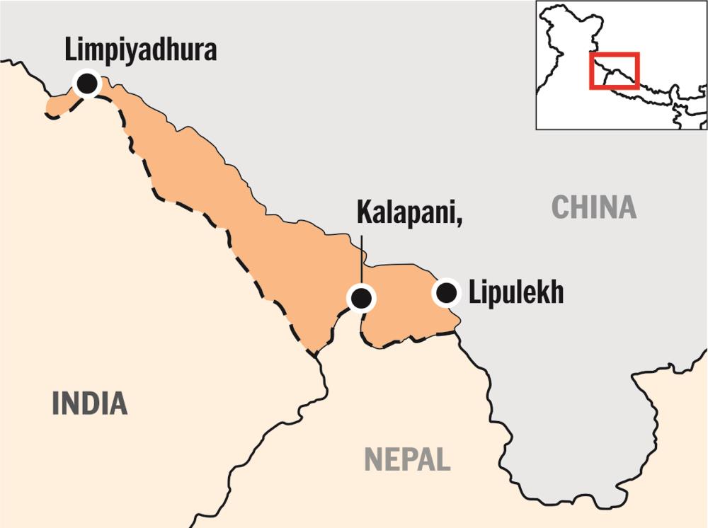
The government is considering the option of using satellite technology to collect census data from Kalapani, Lipulekh, and Limpiyadhura for the new national population and household census.
Information Officer of the Central Bureau of Statistics Tirtha Raj Chaulagain told that the government would first try to seek consent from Indian authorities to go to five villages in Kalapani, Lipulekh, and Limpiyadhura areas and if Indian authorities did not allow Nepali enumerators to count the population in Kalapani gaun, Nabhi Dang, Nabhi, Gunji, and Kuti, Nepali authorities would use satellite technology to ascertain households in those areas.
“Once we have the number of houses in those areas, we can ascertain the possible number of people that live in each household in those areas,” Chaulagain said. He added that government authorities roughly estimated the population of those areas to be around 800. Chaulagain said the Ministry of Foreign Affairs was also trying to contact Indian authorities and seek their cooperation to count the population in those areas.
Asked which country would the government approach for satellite images, Chaulagain said his office might use Google map or purchase new map available on the internet to determine households in Kalapani, Lipulekh, and Limpiyadhura areas.
The Parliament amended the constitution last year depicting Kalapani, Lipulekh, and Limpiyadhura as Nepal’s territories, but these areas remain under India’s political and administrative control. The population census commenced across the nation today.
FACEBOOK COMMENTS