
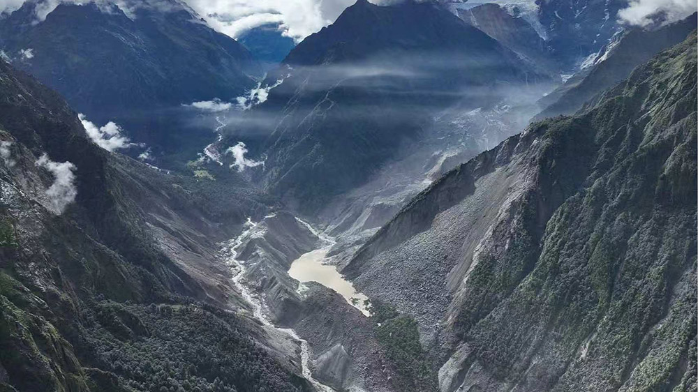
Kathmandu– International experts have warned that a catastrophic rock-ice avalanche following the August 26 (Bhadra 10) Bhote Koshi flood in Nepal highlights the escalating danger of rapid-displacement hazards in the Himalayas and the immense challenges in providing early warnings. Driven by climate change, the destabilization of glaciers and permafrost is expected to make such cascading high-altitude disasters far more frequent in the coming years.
According to preliminary assessments by Chinese authorities, the disaster that struck the Keyirong (Jirong) port originated from a massive rock-ice collapse at an altitude of approximately 5,200 meters on the northern slope of Langtang Lirung in Nepal. The collapsing mass plunged down to an elevation of nearly 4,000 meters, stripping away vast sections of the mountain slope and transforming into a high-velocity debris flood. This torrent traveled nearly 22 kilometers downstream before inundating the Keyirong port at an altitude of 1,800 meters. Researchers noted that the surge reached the port in just 6 to 7 minutes after the initial collapse, illustrating the extremely narrow timeframe available for emergency response.
Geoscientist Dr. Jakob Steiner from the University of Graz, Austria, noted that satellite imagery points toward a fundamental structural bedrock failure at the base of the mountain rather than mere glacial instability. The entrained ice and snow subsequently magnified the volume and spread of the resulting outburst. Steiner emphasized that long-term environmental degradation and cumulative slope destabilization played a far more critical role than short-term surface melting, which acted merely as the final trigger. Similarly, geomorphologist Dr. Kristen Cook from the Institute of Earth Sciences at Grenoble Alpes University, France, confirmed that the primary failure involved deep bedrock, as the glacier volume was too small relative to the massive quantity of rock involved. She explained that climate warming, tectonic forces, and geological processes act jointly on long-term slope stability.
Experts emphasize that the Langtang Lirung disaster challenges traditional classifications of Himalayan hazards, as it was neither a classic Glacial Lake Outburst Flood (GLOF) nor a temporary dam-burst event. Instead, it was a continuous high-speed rock-and-ice flow that did not rely on pre-existing glacial lakes. This mechanism closely resembles the 2021 Chamoli disaster in Uttarakhand, India, where a massive rock-ice collapse triggered a deadly downstream surge that killed over 200 people and destroyed two major hydroelectric projects.
Mitigating such hazards presents formidable technical hurdles. Current early warning systems rely heavily on river gauges, which are often swept away by the initial wave or fail to communicate the actual magnitude of the flood in real time. Moreover, real-time seismic monitoring or automated satellite distortion warnings are not yet operationally deployed. Experts recommend developing automated, satellite-based remote sensing networks to monitor structural slope deformation in remote, high-altitude terrain, enabling scientists to identify precarious mountain slopes before catastrophic failure occurs.














FACEBOOK COMMENTS